Environmental Prediction in the Gulf of Maine
Forecast of North Atlantic right whale births
GoMOOS Buoy N provides data for forecasting right whale births
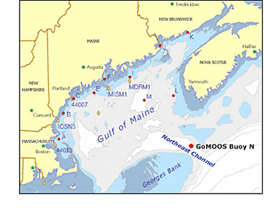
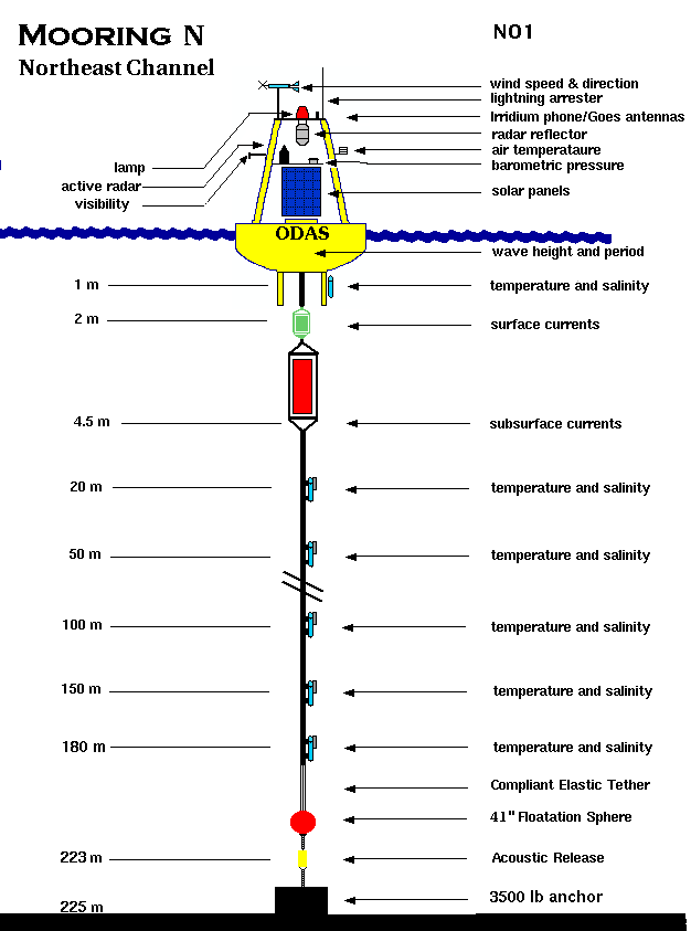
Major exchange between the Gulf of Maine and the North Atlantic occurs through the Northeast Channel, between Georges Bank and Nova Scotia. The GoMOOS buoy array is designed in part to monitor this exchange and its effects throughout the Gulf of Maine. Water from the continental slope enters at depths of 100 to 300 meters and spreads through the Gulf, ultimately bathing the coast with nutrient-rich water. Because the incoming currents vary in temperature, salinity, and nutrients, they can affect circulation patterns, red tides, fisheries, and lobster and right whale reproduction. Whether relatively warm or cold slope water enters the Gulf of Maine depends in part on the North Atlantic Oscillation (NAO).
GoMOOS Buoy N is moored in the Northeast Channel. At multiple depths to 180 meters, it measures water temperature, salinity, and current speed and direction. The data are transmitted automatically to the GoMOOS database and made available online. Buoy N is the only source of long-term monitoring data for the deep waters of the Northeast Channel. As a result, GoMOOS provides critical information for understanding right whale birth rates and other ecological changes related to the influx of slope water. Mathematical models developed by Andrew Pershing (Cornell University) and his collaborators use water temperature data from Buoy N to forecast the whales' food supply, which in turn affects the number of right whales born each year.
See the latest hourly data from GoMOOS Buoy N